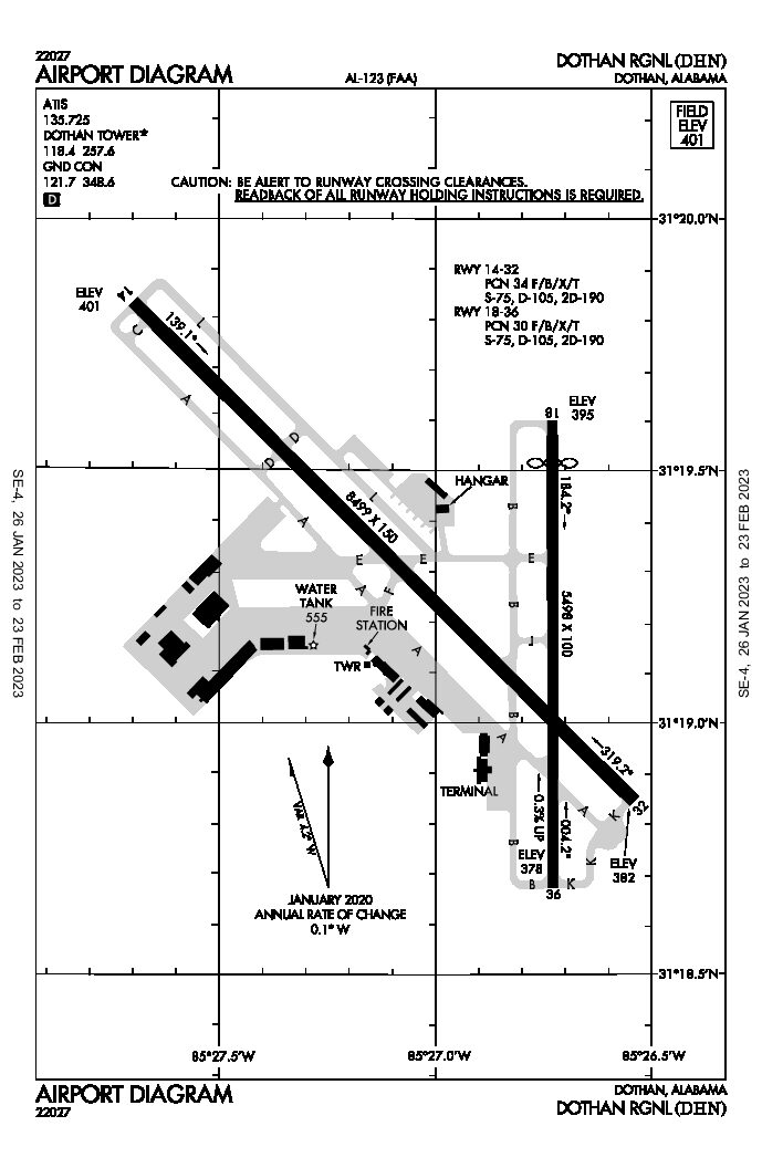
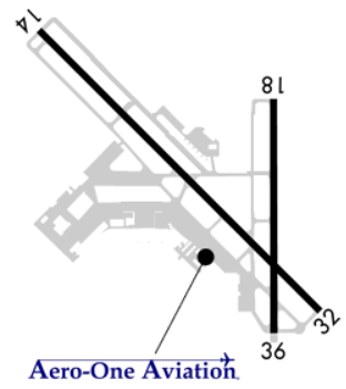
AIRPORT INFORMATION


KDHN Weather Information
Airport Communications
|
Airport use: |
Open to the public |
|
Activation date: |
07/1942 |
|
Control tower: |
yes |
|
ARTCC: |
JACKSONVILLE CENTER |
|
FSS: |
ANNISTON FLIGHT SERVICE STATION |
|
NOTAMs facility: |
DHN (NOTAM-D service available) |
|
Attendance: |
CONTINUOUS |
|
Wind indicator: |
lighted |
|
Segmented circle: |
yes |
|
Lights: |
WHEN ATCT CLSD, ACTVT MALSR RWY 32; REIL RWY 14; PAPI RWY 14; HIRL RWY 14/32 – CTAF. PAPI RWY 18; HIRL RWY 18/36 AVBL BY PRIOR REQ DURG ATNDD HRS, CALL 334-983-8100/8103. REIL RWY 18 OPR BY ATCT WHEN RWY 18 ACTV. |
|
Beacon: |
white-green (lighted land airport) |
|
Fire and rescue: |
ARFF index B |
|
Airline operations: |
48 HR PPR FOR UNSKED ACR OPNS WITH MORE THAN 30 PSGR SEATS 2300-0600 CALL AMGR 334-983-8100. |
|
|
|
Airport Communications
CTAF: 118.4
UNICOM: 122.95
ATIS:135.725
WX ASOS: PHONE 334-983-5999
DOTHAN GROUND: 121.7 [0600-2100 MON-FRI; 0800-2000 SAT & SUN.]
|
DOTHAN TOWER: |
118.4 257.6 [0600-2100 MON-FRI; 0800-2000 SAT & SUN.] |
|
CAIRNS APPROACH: |
125.4 |
|
CAIRNS DEPARTURE: |
125.4 |
Airport Services
|
Fuel available: |
100LL JET-A |
|
Parking: |
hangars and tiedowns |
|
Airframe service: |
MAJOR |
|
Powerplant service: |
MAJOR |
|
Bottled oxygen: |
NONE |
|
Bulk oxygen: |
NONE |
Runway Information
Runway 14/32
|
Dimensions: |
8499 x 150 ft. / 2590 x 46 m |
||||||||||
|
Surface: |
asphalt/grooved, in excellent condition |
||||||||||
|
Weight bearing capacity: |
|
||||||||||
|
Runway edge lights: |
high intensity |
||||||||||
|
RUNWAY 14 |
|
RUNWAY 32 |
|||||||||
|
Latitude: |
31-19.835353N |
31-18.844943N |
|||||||||
|
Longitude: |
085-27.698747W |
085-26.542985W |
|||||||||
|
Elevation: |
400.6 ft. |
381.6 ft. |
|||||||||
|
Traffic pattern: |
left |
left |
|||||||||
|
Runway heading: |
138 magnetic, 135 true |
318 magnetic, 315 true |
|||||||||
|
Declared distances: |
TORA:8496 TODA:8496 ASDA:8496 LDA:8496 |
TORA:8496 TODA:8496 ASDA:8496 LDA:8496 |
|||||||||
|
Markings: |
precision, in good condition |
precision, in good condition |
|||||||||
|
Visual slope indicator: |
2-light PAPI on left (3.00 degrees glide path) |
||||||||||
|
RVR equipment: |
touchdown |
rollout |
|||||||||
|
Approach lights: |
MALSR: 1,400 foot medium intensity approach lighting system with runway alignment indicator lights |
||||||||||
|
Runway end identifier lights: |
yes |
||||||||||
|
Touchdown point: |
yes, no lights |
yes, no lights |
|||||||||
|
Instrument approach: |
ILS/DME |
ILS |
|||||||||
Runway 18/36
|
Dimensions: |
5498 x 100 ft. / 1676 x 30 m |
||||||||||
|
Surface: |
asphalt, in fair condition |
||||||||||
|
Weight bearing capacity: |
|
||||||||||
|
Runway edge lights: |
high intensity |
||||||||||
|
RUNWAY 18 |
|
RUNWAY 36 |
|||||||||
|
Latitude: |
31-19.592488N |
31-18.685603N |
|||||||||
|
Longitude: |
085-26.733603W |
085-26.733453W |
|||||||||
|
Elevation: |
394.7 ft. |
378.4 ft. |
|||||||||
|
Traffic pattern: |
left |
left |
|||||||||
|
Runway heading: |
183 magnetic, 180 true |
003 magnetic, 360 true |
|||||||||
|
Displaced threshold: |
499 ft. |
no |
|||||||||
|
Declared distances: |
TORA:5500 TODA:5500 ASDA:5500 LDA:5000 |
TORA:5000 TODA:5000 ASDA:5000 LDA:5000 |
|||||||||
|
Markings: |
nonprecision, in good condition |
nonprecision, in good condition |
|||||||||
|
Visual slope indicator: |
4-light PAPI on left (3.00 degrees glide path) |
||||||||||
|
Runway end identifier lights: |
yes |
||||||||||
|
Touchdown point: |
yes, no lights |
yes, no lights |
|||||||||
|
Obstructions: |
48 ft. trees, 1400 ft. from runway, 100 ft. left of centerline, 25:1 slope to clear |
80 ft. trees, 2050 ft. from runway, 450 ft. left of centerline, 23:1 slope to clear |
|||||||||
Instrument Procedures
|
ILS OR LOC RWY 14 |
|
|
|
ILS OR LOC RWY 32 |
|
|
|
RNAV (GPS) RWY 14 |
|
|
|
RNAV (GPS) RWY 18 |
|
|
|
RNAV (GPS) RWY 32 |
|
|
|
RNAV (GPS) RWY 36 |
|
|
|
VOR RWY 18 |
|
|
|
VOR OR TACAN RWY 14 |
|
|
|
VOR OR TACAN-A |
|
|
|
COPTER VOR RWY 36 |
|
|


